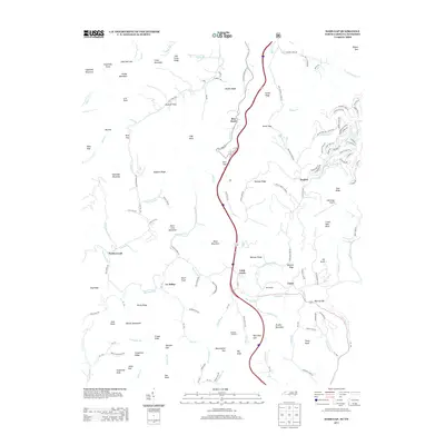
2013 Map of Sams Gap
USGS Topo · Published 2013About this map
English and Faust sit within the mountain-and-creek landscape of the Tennessee and North Carolina border, where the interstate corridor now carves through Sams Gap. This high-altitude terrain is defined by a complex network of ridges and knobs, such as Big Knob and Peter Cove Mountain, which separate the various forks of Big Laurel Cr and Higgins Cr. The map captures a mix of traditional rural architecture and modern utility, from the sanctuary at Ebb Chapel to the Wolf Ridge Airport and the lookout station atop Big Knob Lookout. The winding roads, including Flag Pond Rd and Beauty Spot Cove Rd, follow the natural drainage patterns of Puncheon Fork and Little Creek, reflecting how topographic constraints have long dictated the movement and settlement patterns of this section of the Blue Ridge.
Find a feature on this map
137 named features on this map. Tap any name to fly to it.
Don’t see what you’re looking for? This feature index may not catch every label — zoom into the map to look around manually.
Map Details
Editions of this 2013 Sams Gap Map
This is the sole edition of this map. No revisions or reprints were ever made.
Other maps of this area

1891 · Roan Mountain
USGS Topo · 1:125,000

1892 · Greeneville
USGS Topo · 1:125,000

1894 · Asheville
USGS Topo · 1:125,000

1894 · Roan Mountain
USGS Topo · 1:125,000

1896 · Greeneville
USGS Topo · 1:125,000

1900 · Mount Mitchell
USGS Topo · 1:125,000

1901 · Asheville
USGS Topo · 1:125,000

1902 · Mount Mitchell
USGS Topo · 1:125,000

1904 · Roan Mountain
USGS Topo · 1:125,000

1904 · Greeneville
USGS Topo · 1:125,000