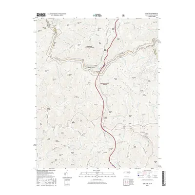
2016 Map of Sams Gap
USGS Topo · Published 2016About this map
Cherokee National Forest and Pisgah National Forest meet along the high ridges of the Bald Mountains, where the modern corridor of Interstate 26 carves through the landscape at Sams Gap. This 2016 survey documents the rural character of the North Carolina and Tennessee border, a region defined by steep topography and isolated valley settlements like English and Faust. The winding path of the Appalachian National Scenic Trail traverses the summits, crossing from Big Flat toward Street Gap. For family historians, the map is a vital resource for locating upland burial grounds, including Robinson Cem, Shook Cem, and Murray Gap Cem. The presence of Wolf Ridge Airport near Lower Haw Knob highlights how modern infrastructure has been integrated into the traditional mountain terrain of Unicoi and Madison counties.
Find a feature on this map
117 named features on this map. Tap any name to fly to it.
Don’t see what you’re looking for? This feature index may not catch every label — zoom into the map to look around manually.
Map Details
Editions of this 2016 Sams Gap Map
This is the sole edition of this map. No revisions or reprints were ever made.
Other maps of this area

1891 · Roan Mountain
USGS Topo · 1:125,000

1892 · Greeneville
USGS Topo · 1:125,000

1894 · Asheville
USGS Topo · 1:125,000

1894 · Roan Mountain
USGS Topo · 1:125,000

1896 · Greeneville
USGS Topo · 1:125,000

1900 · Mount Mitchell
USGS Topo · 1:125,000

1901 · Asheville
USGS Topo · 1:125,000

1902 · Mount Mitchell
USGS Topo · 1:125,000

1904 · Roan Mountain
USGS Topo · 1:125,000

1904 · Greeneville
USGS Topo · 1:125,000