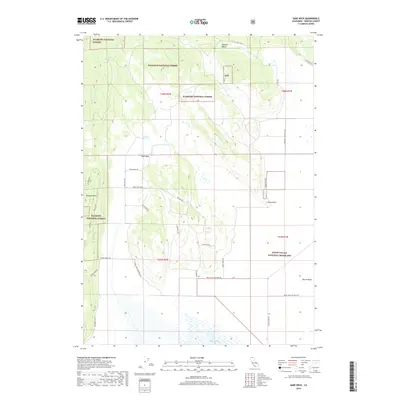
2018 Map of Sams Neck
USGS Topo · Published 2018About this map
Klamath National Forest dominates the western half of this 2018 survey, characterized by the prominent elevation of McGavin Peak and the unique landform of Sams Neck. The terrain transitions abruptly into the low-lying basin of the Butte Valley National Grassland, where the expansive Meiss Lake sits near the southern boundary. This area reflects a landscape primarily defined by conservation and water management, with numerous named roads such as School House Rd and Old State Hwy hinting at earlier settlement patterns and historic travel corridors.
Find a feature on this map
29 named features on this map. Tap any name to fly to it.
Don’t see what you’re looking for? This feature index may not catch every label — zoom into the map to look around manually.
Map Details
Editions of this 2018 Sams Neck Map
This is the sole edition of this map. No revisions or reprints were ever made.
Other maps of this area

1886 · Modoc Lava Bed
USGS Topo · 1:250,000

1886 · Shasta
USGS Topo · 1:250,000

1889 · Klamath
USGS Topo · 1:250,000

1891 · Ashland
USGS Topo · 1:250,000

1892 · Modoc Lava-Bed
USGS Topo · 1:250,000

1893 · Ashland
USGS Topo · 1:250,000

1894 · Klamath
USGS Topo · 1:250,000

1894 · Shasta
USGS Topo · 1:250,000

1897 · Ashland
USGS Topo · 1:250,000

1934 · Macdoel
USGS Topo · 1:96,000