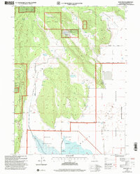
2001 Map of Sams Neck
USGS Topo · Published 2004About this map
McGavin Peak dominates the western topography of this Siskiyou County landscape, where the high timber of the Klamath National Forest meets the managed wetlands of the Butte Valley Wildlife Area. The map reveals a highly engineered agricultural and conservation environment, defined by the Levee system and multiple water management features including a Pumping Station and numerous infrastructure points like Well 4237.
Find a feature on this map
34 named features on this map. Tap any name to fly to it.
Don’t see what you’re looking for? This feature index may not catch every label — zoom into the map to look around manually.
Map Details
Editions of this 2001 Sams Neck Map
This is the sole edition of this map. No revisions or reprints were ever made.
Other maps of this area

1886 · Modoc Lava Bed
USGS Topo · 1:250,000

1886 · Shasta
USGS Topo · 1:250,000

1889 · Klamath
USGS Topo · 1:250,000

1891 · Ashland
USGS Topo · 1:250,000

1892 · Modoc Lava-Bed
USGS Topo · 1:250,000

1893 · Ashland
USGS Topo · 1:250,000

1894 · Klamath
USGS Topo · 1:250,000

1894 · Shasta
USGS Topo · 1:250,000

1897 · Ashland
USGS Topo · 1:250,000

1934 · Macdoel
USGS Topo · 1:96,000