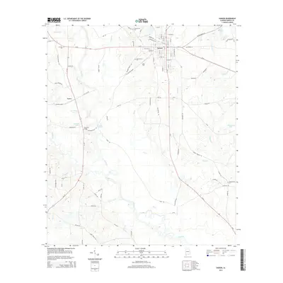
2014 Map of Samson
USGS Topo · Published 2014About this map
Samson serves as the central hub of this South Alabama landscape, where the confluence of several regional routes like Al-52 and Al-87 meets the winding course of the Pea River. The river corridor is a primary geographic feature, crossed by the Hays Ferry Bridge and flanked by numerous tributaries such as Gin Cr and Sandy Cr. Evidence of the area's agricultural and social history is found in the distribution of family and community landmarks, including the Hall and Rivers Cem and Liberty Chapel. North of the town center, Logan Field and Travelers Rest Cem mark the transition toward more rural terrain. The presence of the Old Railroad Grade and Old Rail Grade near the settlement of Ganer illustrates the historical transportation infrastructure that once connected these rural communities to the wider regional economy. Small water bodies like Neal Spears Lake and Sellers Fishpond dot the countryside, supporting the local agricultural character.
Find a feature on this map
89 named features on this map. Tap any name to fly to it.
Don’t see what you’re looking for? This feature index may not catch every label — zoom into the map to look around manually.
Map Details
Editions of this 2014 Samson Map
This is the sole edition of this map. No revisions or reprints were ever made.
Other maps of this area

1942 · Enterprise
USGS Topo · 1:125,000

1949 · Glendale
USGS Topo · 1:62,500

1949 · Hobbs Crossroads
USGS Topo · 1:24,000

1950 · Hobbs Cross Roads
USGS Topo · 1:24,000

1951 · Glendale
USGS Topo · 1:62,500

1953 · Andalusia
USGS Topo · 1:250,000

1953 · Dothan
USGS Topo · 1:250,000

1954 · Dothan
USGS Topo · 1:250,000

1954 · Tallahassee
USGS Topo · 1:250,000

1955 · Dothan
USGS Topo · 1:250,000