Loading...
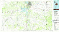
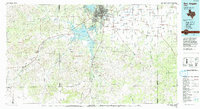
Loading map...1986 Map of San Angelo
USGS Topo · Published 1986About this map
The confluence of the North Concho River, Middle Concho River, and South Concho River forms the geographic heart of the Concho Valley, where San Angelo sits as a regional hub. By the mid-1980s, the landscape surrounding the city was defined by large-scale water management and energy extraction. Major reservoirs including Twin Buttes Reservoir, Lake Nasworthy, and O C Fisher Lake dominate the immediate vicinity of the city, while the extensive Lipan Flat stretches to the east.
Find a feature on this map
67 named features on this map. Tap any name to fly to it.
Don’t see what you’re looking for? This feature index may not catch every label — zoom into the map to look around manually.
Map Details
Date Portrayed1986
Date Published1986
PublisherU.S. Geological Survey
Map TypeTopographic
Scale1:100,000
Physical Dimensions43.9 x 24.1 inches
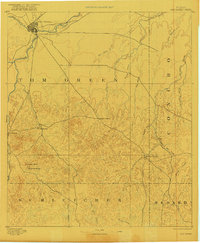
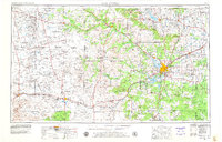
Editions of this 1986 San Angelo Map
2 editions found
Historical Maps of San Angelo Through Time
5 maps found


Featured Locations
Source Details
SourceU.S. Geological Survey
CopyrightPublic Domain