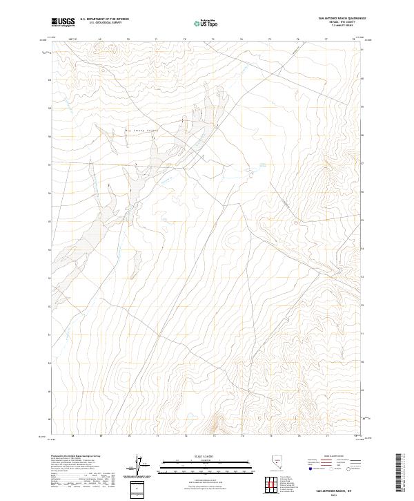
2021 Map of San Antonio Ranch
USGS Topo · Published 2021About this map
Big Smoky Valley dominates the northern reaches of this terrain, where the expansive desert basin meets the drainage systems of the San Antonio Mountains. The map highlights a critical watering point at Indian Springs, a vital resource in this arid environment. Transportation through this part of Nye County is defined by the historic Fremont Rte cutting across the northeastern corner and the more modern Anaconda Rd traversing the eastern slopes. These routes suggest a landscape shaped by both early exploration and later industrial or mining access. Drainage patterns are clearly marked by seasonal watercourses like Peavine Cr and Cottonwood Creek, which flow from the higher elevations toward the valley floor, illustrating the complex hydrography of the Great Basin.
Find a feature on this map
11 named features on this map. Tap any name to fly to it.
Don’t see what you’re looking for? This feature index may not catch every label — zoom into the map to look around manually.
Map Details
Editions of this 2021 San Antonio Ranch Map
This is the sole edition of this map. No revisions or reprints were ever made.
Other maps of this area

1907 · Tonopah
USGS Topo · 1:250,000

1908 · Tonopah
USGS Topo · 1:250,000

1956 · Tonopah
USGS Topo · 1:250,000

1959 · Tonopah
USGS Topo · 1:250,000

1962 · Tonopah
USGS Topo · 1:250,000

1963 · Baxter Spring
USGS Topo · 1:62,500

1964 · San Antonio Ranch
USGS Topo · 1:62,500

1971 · Seyler Peak
USGS Topo · 1:24,000

1980 · Secret Basin
USGS Topo · 1:24,000
1980 · Peavine Ranch
USGS Topo · 1:24,000