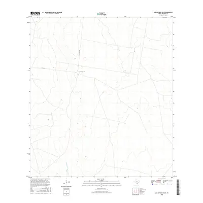
2016 Map of San Antonio Viejo
USGS Topo · Published 2016About this map
San Antonio Viejo sits as the central point of interest in this Jim Hogg County landscape, reflecting the remote ranching heritage of Deep South Texas. This 2016 survey highlights the sparse, cattle-country infrastructure defined by long-distance tracks like Gallagher Ranch Rd and E Ranch Rd. The terrain is characterized by subtle elevation changes and seasonal drainage patterns, most notably Remadura de Charco Largo Cr, which winds through the southern portion of the quadrangle. For those studying modern land use or family ranching boundaries, the map provides a clear view of the existing road networks and water features that have sustained this arid region for generations.
Find a feature on this map
4 named features on this map. Tap any name to fly to it.
Don’t see what you’re looking for? This feature index may not catch every label — zoom into the map to look around manually.
Map Details
Editions of this 2016 San Antonio Viejo Map
This is the sole edition of this map. No revisions or reprints were ever made.
Other maps of this area

1938 · Agua Nueva
USGS Topo · 1:62,500

1938 · Cuevitas
USGS Topo · 1:62,500

1939 · Randado
USGS Topo · 1:62,500

1940 · Randado
USGS Topo · 1:62,500

1949 · Mc Allen
USGS Topo · 1:250,000

1954 · McAllen
USGS Topo · 1:250,000

1956 · Laredo
USGS Topo · 1:250,000

1957 · Mc Allen
USGS Topo · 1:250,000

1962 · McAllen
USGS Topo · 1:250,000
1972 · San Pablo Ranch
USGS Topo · 1:24,000