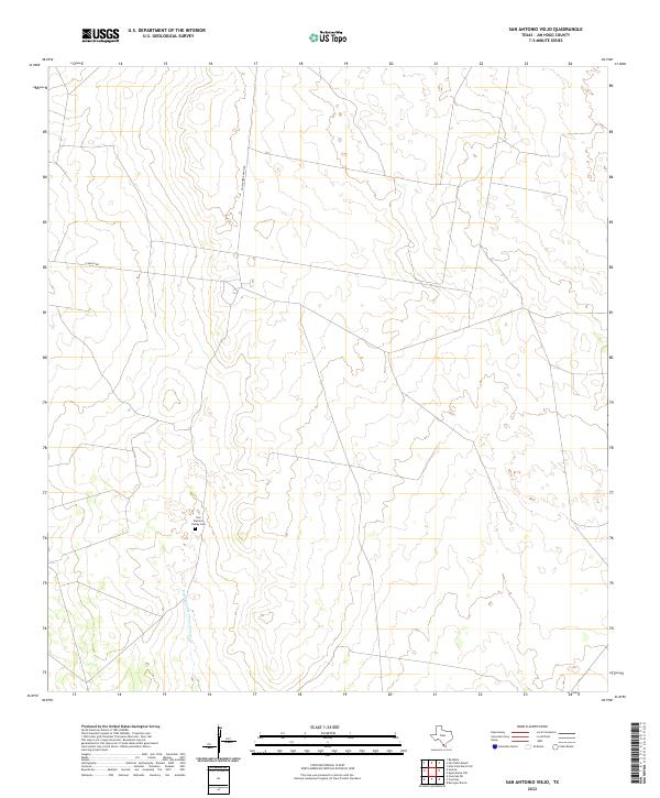
2022 Map of San Antonio Viejo
USGS Topo · Published 2022About this map
Family heritage and the open ranchlands of South Texas define this landscape in Jim Hogg County. The map provides specific genealogical value by locating the Lino Ramirez Family Cem, a remote burial site situated north of the ephemeral Remadura de Charco Largo Cr. The terrain is characterized by a sparse network of private roads and drainage courses, illustrating the expansive nature of rural Texas landholdings. Transport through this area relies on isolated routes such as Gallagher Ranch Rd and E Ranch Rd, which navigate the subtle contours of the brush country. This survey serves as a precise record of contemporary land use and family landmarks in a region where few major settlements exist.
Find a feature on this map
4 named features on this map. Tap any name to fly to it.
Don’t see what you’re looking for? This feature index may not catch every label — zoom into the map to look around manually.
Map Details
Editions of this 2022 San Antonio Viejo Map
This is the sole edition of this map. No revisions or reprints were ever made.
Other maps of this area

1938 · Agua Nueva
USGS Topo · 1:62,500

1938 · Cuevitas
USGS Topo · 1:62,500

1939 · Randado
USGS Topo · 1:62,500

1940 · Randado
USGS Topo · 1:62,500

1949 · Mc Allen
USGS Topo · 1:250,000

1954 · McAllen
USGS Topo · 1:250,000

1956 · Laredo
USGS Topo · 1:250,000

1957 · Mc Allen
USGS Topo · 1:250,000

1962 · McAllen
USGS Topo · 1:250,000
1972 · San Pablo Ranch
USGS Topo · 1:24,000