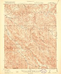
1919 Map of San Benito
USGS Topo · Published 1919About this map
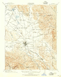
The San Benito River winds through this rugged section of the Call Mountains during the late 1910s, defining a landscape of isolated ranching outposts and remote mountain schools. The topography is dominated by steep ridges like Chemise Ridge and the prominent Sugar Loaf peak, with early transit routes such as the Hollister Road and New Idria Road providing the only reliable passage through the terrain. Evidence of early California industry appears at the Bradford Mine, while the southern reaches of the map highlight the early boundaries of Pinnacles Nat Mon.
Find a feature on this map
35 named features on this map. Tap any name to fly to it.
Don’t see what you’re looking for? This feature index may not catch every label — zoom into the map to look around manually.
Map Details
Editions of this 1919 San Benito Map
2 editions found
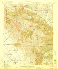
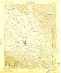
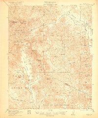
Other maps of this area

1913 · Panoche
USGS Topo · 1:125,000

1915 · Soledad
USGS Topo · 1:62,500

1915 · Priest Valley
USGS Topo · 1:125,000

1919 · San Benito
USGS Topo · 1:62,500

1919 · Hollister
USGS Topo · 1:48,000
1921 · Gonzales
USGS Topo · 1:62,500

1921 · Metz
USGS Topo · 1:62,500
1921 · Hollister
USGS Topo · 1:62,500
1922 · Quien Sabe
USGS Topo · 1:62,500
1923 · Hollister
USGS Topo · 1:62,500