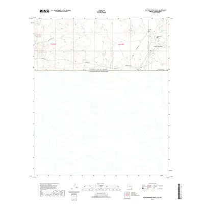
2018 Map of San Bernardino Ranch
USGS Topo · Published 2018About this map
San Bernardino Ranch occupies a critical position along the international border, where the high desert of the San Bernardino Valley meets the northern reaches of Sonora. This 2018 survey documents a landscape defined by intermittent drainage systems and historic transit corridors. The area is anchored by the presence of Astin Spring and the passage of Silver Creek, which flow toward the southern boundary. Infrastructure like the Geronimo Trail Bridge and Slaughter Ranch Rd underscores the site's role as a ranching and travel hub in Cochise County. The map provides a detailed look at the topographic contours of Cottonwood Draw and the Black Draw Trail, reflecting the enduring paths used for movement across this binational territory.
Find a feature on this map
17 named features on this map. Tap any name to fly to it.
Don’t see what you’re looking for? This feature index may not catch every label — zoom into the map to look around manually.
Map Details
Editions of this 2018 San Bernardino Ranch Map
This is the sole edition of this map. No revisions or reprints were ever made.
Other maps of this area

1919 · Perilla
USGS Topo · 1:125,000

1922 · McDonald
USGS Topo · 1:62,500

1940 · College Peaks
USGS Topo · 1:62,500

1955 · Douglas
USGS Topo · 1:250,000

1958 · Guadalupe Canyon
USGS Topo · 1:62,500
1958 · College Peaks
USGS Topo · 1:62,500

1959 · Douglas
USGS Topo · 1:250,000

1961 · Douglas
USGS Topo · 1:250,000

1964 · Douglas
USGS Topo · 1:250,000
1985 · San Bernardino Ranch
USGS Topo · 1:24,000