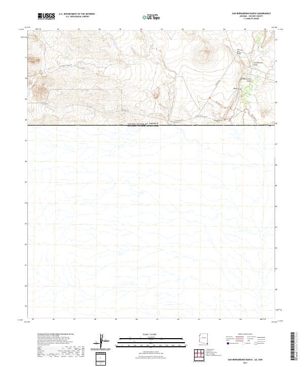
2021 Map of San Bernardino Ranch
USGS Topo · Published 2021About this map
San Bernardino Ranch occupies a critical historical corridor along the international boundary between the United States and Mexico. Located within the San Bernardino Valley, the landscape is defined by its arid water network, including Astin Spring and the drainage systems of Cottonwood Draw and Black Draw. These water sources have long dictated the movement of people and livestock in this border region, supporting a ranching economy that persists through modern times.
Find a feature on this map
18 named features on this map. Tap any name to fly to it.
Don’t see what you’re looking for? This feature index may not catch every label — zoom into the map to look around manually.
Map Details
Editions of this 2021 San Bernardino Ranch Map
This is the sole edition of this map. No revisions or reprints were ever made.
Other maps of this area

1919 · Perilla
USGS Topo · 1:125,000

1922 · McDonald
USGS Topo · 1:62,500

1940 · College Peaks
USGS Topo · 1:62,500

1955 · Douglas
USGS Topo · 1:250,000

1958 · Guadalupe Canyon
USGS Topo · 1:62,500
1958 · College Peaks
USGS Topo · 1:62,500

1959 · Douglas
USGS Topo · 1:250,000

1961 · Douglas
USGS Topo · 1:250,000

1964 · Douglas
USGS Topo · 1:250,000
1985 · San Bernardino Ranch
USGS Topo · 1:24,000