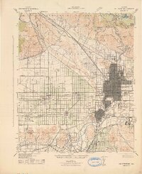
1942 Map of San Bernardino
USGS Topo · Published 1942About this map
San Bernardino sits at the foot of the San Gabriel Mountains in this early wartime survey, appearing as a growing hub defined by its citrus industry and railway connections. The grid of the city and its surrounding settlements—including Fontana, Rialto, and Colton—is extensively detailed, showing the National Orange Show grounds and the Court House at the center of civic life. The landscape is a mix of agricultural tracts and heavy industry, most notably the Calif Portland Cement facility near Slover Mt.
Find a feature on this map
83 named features on this map. Tap any name to fly to it.
Don’t see what you’re looking for? This feature index may not catch every label — zoom into the map to look around manually.
Map Details
Editions of this 1942 San Bernardino Map
This is the sole edition of this map. No revisions or reprints were ever made.
Other maps of this area

1896 · San Bernardino
USGS Topo · 1:62,500

1897 · Cucamonga
USGS Topo · 1:62,500

1898 · San Bernardino
USGS Topo · 1:62,500

1899 · Redlands
USGS Topo · 1:62,500

1900 · Cucamonga
USGS Topo · 1:62,500

1901 · Southern California Sheet No. 1
USGS Topo · 1:250,000

1901 · San Bernardino
USGS Topo · 1:62,500

1901 · Redlands
USGS Topo · 1:62,500

1901 · Elsinore
USGS Topo · 1:125,000

1901 · Riverside
USGS Topo · 1:62,500