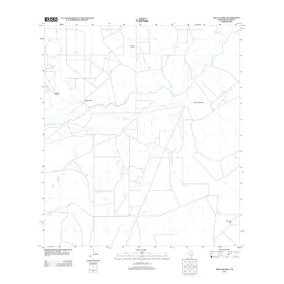
2013 Map of San Caja Hill
USGS Topo · Published 2013About this map
The Nueces River meanders across this rural expanse of McMullen County, creating a complex drainage network defined by the Old River and various seasonal tributaries. The topography is marked by significant drainage features such as Dragoon Hollow, Lagrand Hollow, and San Caja Hollow, which illustrate the erosive power of water on this South Texas landscape. Rising above the lowlands is San Caja Hill, a prominent landmark in the southeast corner of the map that provides a vertical contrast to the surrounding flats. Land use appears primarily agricultural or ranch-based, evidenced by the sparse road network and scattered clearings. Notable landmarks like Drakes Point and several named creeks, including Hill Cr, Spur Cr, and Dragoon Cr, serve as important navigational markers for local landholders and genealogists tracing family holdings in this corner of the state.
Find a feature on this map
10 named features on this map. Tap any name to fly to it.
Don’t see what you’re looking for? This feature index may not catch every label — zoom into the map to look around manually.
Map Details
Editions of this 2013 San Caja Hill Map
This is the sole edition of this map. No revisions or reprints were ever made.
Other maps of this area

1920 · Mikeska
USGS Topo · 1:125,000

1925 · Simmons No. 1
USGS Topo · 1:48,000

1925 · Tilden No. 1
USGS Topo · 1:48,000

1925 · Simmons No. 2
USGS Topo · 1:48,000

1929 · Simmons
USGS Topo · 1:62,500

1930 · Tilden
USGS Topo · 1:62,500

1937 · Loma Alta
USGS Topo · 1:62,500

1942 · Tilden
USGS Topo · 1:62,500

1953 · Crystal City
USGS Topo · 1:250,000

1955 · Crystal City
USGS Topo · 1:250,000