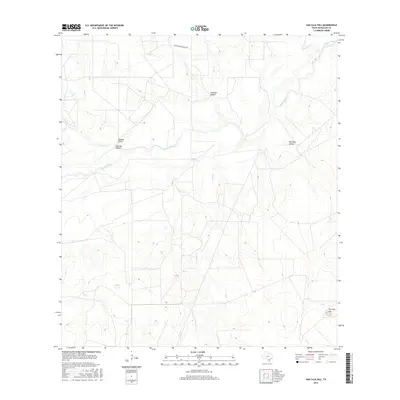
2016 Map of San Caja Hill
USGS Topo · Published 2016About this map
The Nueces River winds through this South Texas landscape, creating a complex hydrologic network of creeks and abandoned channels such as the Old River. The topography is defined by distinct elevations and drainage features, most notably the prominent San Caja Hill in the southeast and Drakes Point to the west. These high points are separated by various depressions and drainages including San Caja Hollow, Lagrand Hollow, and Dragoon Hollow. This 2016 survey illustrates a sparsely settled region of McMullen County characterized by ranching infrastructure, as evidenced by the Four Sisters Ranch Rd. The intersection of multiple watercourses, including Hill Cr, Dragoon Cr, and Spur Cr, suggests a terrain shaped by periodic flooding and the shifting path of the main river system over time.
Find a feature on this map
11 named features on this map. Tap any name to fly to it.
Don’t see what you’re looking for? This feature index may not catch every label — zoom into the map to look around manually.
Map Details
Editions of this 2016 San Caja Hill Map
This is the sole edition of this map. No revisions or reprints were ever made.
Other maps of this area

1920 · Mikeska
USGS Topo · 1:125,000

1925 · Simmons No. 1
USGS Topo · 1:48,000

1925 · Tilden No. 1
USGS Topo · 1:48,000

1925 · Simmons No. 2
USGS Topo · 1:48,000

1929 · Simmons
USGS Topo · 1:62,500

1930 · Tilden
USGS Topo · 1:62,500

1937 · Loma Alta
USGS Topo · 1:62,500

1942 · Tilden
USGS Topo · 1:62,500

1953 · Crystal City
USGS Topo · 1:250,000

1955 · Crystal City
USGS Topo · 1:250,000