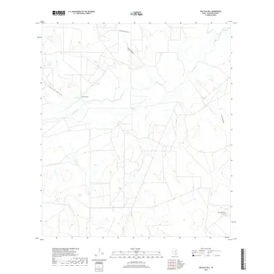
2019 Map of San Caja Hill
USGS Topo · Published 2019About this map
The Nueces River winds through this central McMullen County landscape, defining a network of drainage patterns that include Old River and Hill Cr. This portion of South Texas is characterized by its distinct topographic markers, most notably San Caja Hill in the southeast and Drakes Point further west. These elevations rise above a series of named depressions such as San Caja Hollow and Lagrand Hollow, which channel seasonal runoff toward the river basin. While largely open ranch land, the area is connected by Four Sisters Ranch Rd in the north. The map documents a landscape of intermittent waterways like Spur Cr and Dragoon Cr, illustrating the vital role of riparian corridors in this brush country environment.
Find a feature on this map
11 named features on this map. Tap any name to fly to it.
Don’t see what you’re looking for? This feature index may not catch every label — zoom into the map to look around manually.
Map Details
Editions of this 2019 San Caja Hill Map
This is the sole edition of this map. No revisions or reprints were ever made.
Other maps of this area

1920 · Mikeska
USGS Topo · 1:125,000

1925 · Simmons No. 1
USGS Topo · 1:48,000

1925 · Tilden No. 1
USGS Topo · 1:48,000

1925 · Simmons No. 2
USGS Topo · 1:48,000

1929 · Simmons
USGS Topo · 1:62,500

1930 · Tilden
USGS Topo · 1:62,500

1937 · Loma Alta
USGS Topo · 1:62,500

1942 · Tilden
USGS Topo · 1:62,500

1953 · Crystal City
USGS Topo · 1:250,000

1955 · Crystal City
USGS Topo · 1:250,000