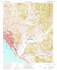
1968 Map of San Clemente
USGS Topo · Published 1978About this map
The coastal transition from Orange County into San Diego County is defined by the burgeoning development of San Clemente and the expansive northern reaches of Camp Pendleton Marine Corps Base. This late-sixties landscape, with purple revisions from the mid-seventies, shows the growing suburban footprint around El Camino Real and the San Diego Freeway, even as traditional landmarks like the San Clemente Pier and San Clemente State Beach anchor the shoreline. The map captures a moment of infrastructure growth, from the San Clemente High Sch and Concordia Sch to the industrial Sewage Disposal Ponds. Inland, the terrain remains marked by deep drainage canyons like Talega Canyon and San Mateo Creek, while the historic Cristianitos Historic Site sits near the military boundary. Along the coast, the Atchison Topeka and Santa Fe railroad tracks follow the bluffs past San Mateo Pt toward San Onofre.
Find a feature on this map
43 named features on this map. Tap any name to fly to it.
Don’t see what you’re looking for? This feature index may not catch every label — zoom into the map to look around manually.
Map Details
Editions of this 1968 San Clemente Map
3 editions found
Other maps of this area

1901 · Southern California Sheet No. 1
USGS Topo · 1:250,000

1901 · Elsinore
USGS Topo · 1:125,000

1901 · San Luis Rey
USGS Topo · 1:125,000

1902 · Capistrano
USGS Topo · 1:125,000

1902 · Corona
USGS Topo · 1:125,000

1904 · Southern California Sheet No. 2
USGS Topo · 1:250,000

1904 · Southern California Sheet No. 1
USGS Topo · 1:250,000

1906 · Capistrano
USGS Topo · 1:125,000

1941 · Margarita Peak
USGS Topo · 1:62,500

1942 · Lake Elsinore
USGS Topo · 1:62,500
Featured Places
- San Clemente, CA
- San Juan Capistrano, CA
- Marine Corps Base Camp Pendleton, CA
- San Onofre, Marine Corps Base Camp Pendleton
- San Diego County, CA