
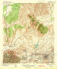
1930 Map of San Diego
USGS Topo · Published 1960About this map
San Diego Bay dominates this coastal landscape, serving as the focal point for a massive naval and aviation presence during the interwar years. Military facilities line the waterfront, from the U.S. Naval Training Station and US Marine Base in the north to the U.S. Naval Destroyer Base further south. Aviation history is centered on North Island, which houses Rockwell Field (Aviation) and the U.S. Naval Air Station adjacent to the newly established Lindbergh Airport.
Find a feature on this map
65 named features on this map. Tap any name to fly to it.
Don’t see what you’re looking for? This feature index may not catch every label — zoom into the map to look around manually.
Map Details
Editions of this 1930 San Diego Map
This is the sole edition of this map. No revisions or reprints were ever made.
Other maps of this area

1893 · El Cajon
USGS Topo · 1:62,500

1901 · Elcajon
USGS Topo · 1:62,500

1903 · Cuyamaca
USGS Topo · 1:125,000

1903 · La Jolla
USGS Topo · 1:62,500

1903 · Elcajon
USGS Topo · 1:62,500

1904 · San Diego
USGS Topo · 1:62,500

1904 · Southern California Sheet No. 2
USGS Topo · 1:250,000

1930 · La Jolla
USGS Topo · 1:62,500

1939 · El Cajon
USGS Topo · 1:62,500
1942 · La Mesa
USGS Topo · 1:31,680