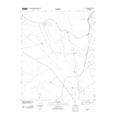
2012 Map of San Felipe
USGS Topo · Published 2012About this map
San Felipe Lake and the agricultural expanse of the Hollister Valley define this landscape south of the Pajaro River. This 2012 survey illustrates the enduring viticultural legacy of the region, anchored by the Almaden Vineyards and Cascade Ruta Winery near the intersection of Walnut Ave. Small settlements and naming conventions like Dunneville, Bolsa, and Hudner reflect a long-standing rural community structure, while the Hollister Municipal Airport and Frazier Lake Airpark indicate the valley's modern aviation role.
Find a feature on this map
52 named features on this map. Tap any name to fly to it.
Don’t see what you’re looking for? This feature index may not catch every label — zoom into the map to look around manually.
Map Details
Editions of this 2012 San Felipe Map
This is the sole edition of this map. No revisions or reprints were ever made.
Other maps of this area

1915 · San Juan Bautista
USGS Topo · 1:48,000

1917 · Morgan Hill
USGS Topo · 1:62,500

1917 · San Juan Bautista
USGS Topo · 1:62,500

1919 · Hollister
USGS Topo · 1:48,000

1921 · Gilroy Hot Springs
USGS Topo · 1:62,500

1921 · Hollister
USGS Topo · 1:62,500

1923 · Hollister
USGS Topo · 1:62,500

1939 · Morgan Hill
USGS Topo · 1:62,500

1939 · Gilroy Hot Springs
USGS Topo · 1:62,500

1939 · San Juan Bautista
USGS Topo · 1:62,500