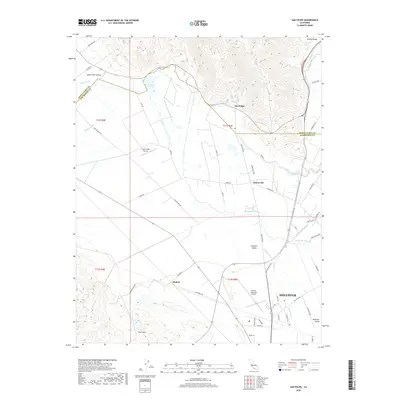
2018 Map of San Felipe
USGS Topo · Published 2018About this map
Hollister anchors the southern landscape of this 2018 survey, where the Hollister Valley meets the rising elevations of the Flint Hills. The area is defined by a complex hydrologic network, including the Pajaro River and San Felipe Lake, which feed into the Millers Canal. Small rural settlements and intersections like San Felipe, Dunneville, and Hudner are scattered across the valley floor, connected by a grid of agricultural roads such as Shore Rd and Frazier Lake Rd.
Find a feature on this map
56 named features on this map. Tap any name to fly to it.
Don’t see what you’re looking for? This feature index may not catch every label — zoom into the map to look around manually.
Map Details
Editions of this 2018 San Felipe Map
This is the sole edition of this map. No revisions or reprints were ever made.
Other maps of this area

1915 · San Juan Bautista
USGS Topo · 1:48,000

1917 · Morgan Hill
USGS Topo · 1:62,500

1917 · San Juan Bautista
USGS Topo · 1:62,500

1919 · Hollister
USGS Topo · 1:48,000

1921 · Gilroy Hot Springs
USGS Topo · 1:62,500

1921 · Hollister
USGS Topo · 1:62,500

1923 · Hollister
USGS Topo · 1:62,500

1939 · Morgan Hill
USGS Topo · 1:62,500

1939 · Gilroy Hot Springs
USGS Topo · 1:62,500

1939 · San Juan Bautista
USGS Topo · 1:62,500