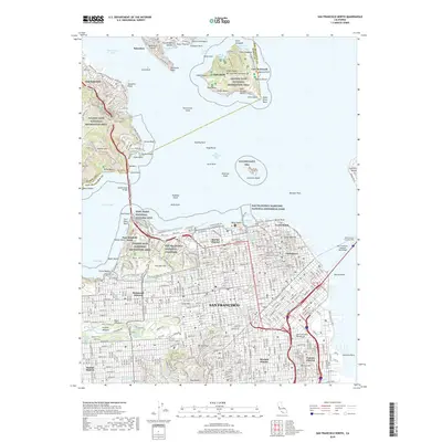
2018 Map of San Francisco North
USGS Topo · Published 2018About this map
Angel Island and the northern tip of the San Francisco Peninsula dominate this modern survey, capturing the complex urban and maritime geography of the Golden Gate. On the southern shore, the military and historical footprint of the Presidio is clearly defined, featuring the San Francisco National Cemetery and Fort Winfield Scott. The map provides an intricate look at the city's established neighborhoods, from the Marina District and Chinatown to the Mission District, where the dense grid is broken by the green spaces of Presidio Hill and the lakes of Golden Gate Park, such as Stow Lake and Spreckels Lake.
Find a feature on this map
118 named features on this map. Tap any name to fly to it.
Don’t see what you’re looking for? This feature index may not catch every label — zoom into the map to look around manually.
Map Details
Editions of this 2018 San Francisco North Map
This is the sole edition of this map. No revisions or reprints were ever made.
Other maps of this area

1892 · San Mateo
USGS Topo · 1:62,500

1895 · San Francisco
USGS Topo · 1:62,500

1896 · San Mateo
USGS Topo · 1:62,500

1897 · Tamalpais
USGS Topo · 1:62,500

1899 · San Francisco
USGS Topo · 1:62,500

1899 · San Mateo
USGS Topo · 1:62,500

1915 · San Mateo
USGS Topo · 1:62,500

1915 · San Francisco
USGS Topo · 1:62,500

1939 · San Mateo
USGS Topo · 1:62,500

1941 · Tamalpais
USGS Topo · 1:62,500