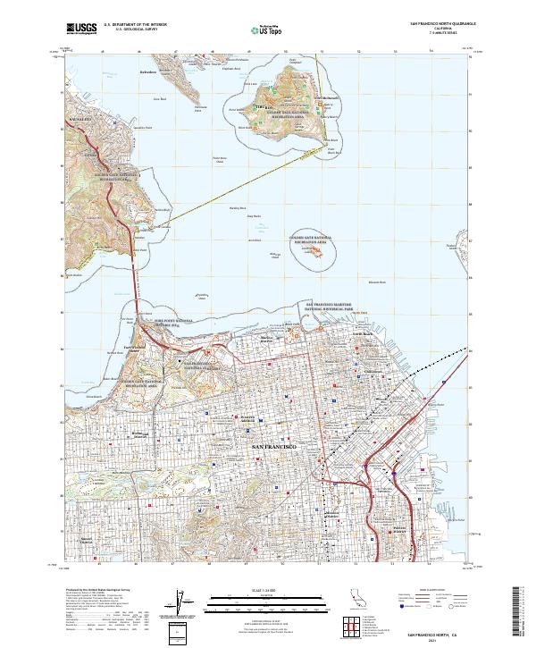
2021 Map of San Francisco North
USGS Topo · Published 2021About this map
San Francisco and the northern reaches of the San Francisco Bay define this landscape, anchored by the dense urban grid of the Marina District, Chinatown, and the Western Addition. The map traces the rugged coastline from China Beach past the Presidio to the historic fortifications of Fort Winfield Scott and Fort Point. Across the Golden Gate, the survey details the heights of Sausalito and the residential enclaves of the Tiburon Peninsula. On Angel Island, features like Fort McDowell and Mt Caroline Livermore stand alongside the working history of Quarry Point. Notable for genealogists and local historians are the numerous spiritual and civic landmarks, including St Marys Cathedral, Grace Cathedral, and the San Francisco National Cemetery, providing a precise look at the city's established religious and commemorative geography.
Find a feature on this map
280 named features on this map. Tap any name to fly to it.
Don’t see what you’re looking for? This feature index may not catch every label — zoom into the map to look around manually.
Map Details
Editions of this 2021 San Francisco North Map
This is the sole edition of this map. No revisions or reprints were ever made.
Other maps of this area

1892 · San Mateo
USGS Topo · 1:62,500

1895 · San Francisco
USGS Topo · 1:62,500

1896 · San Mateo
USGS Topo · 1:62,500

1897 · Tamalpais
USGS Topo · 1:62,500

1899 · San Francisco
USGS Topo · 1:62,500

1899 · San Mateo
USGS Topo · 1:62,500

1915 · San Mateo
USGS Topo · 1:62,500

1915 · San Francisco
USGS Topo · 1:62,500

1939 · San Mateo
USGS Topo · 1:62,500

1941 · Tamalpais
USGS Topo · 1:62,500