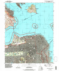
1993 Map of San Francisco North
USGS Topo · Published 1997About this map
San Francisco sits at the nexus of the Pacific and the bay, anchored by the massive green space of the Presidio of San Francisco. The urban landscape is meticulously detailed, showing the dense grid of the Chinatown, Western Addition, and the Mission District before the skyline began its modern transformation. To the north, the Golden Gate Bridge connects the city to the Marin Peninsula, while the San Francisco-Oakland Bay Bridge and the Trans-Bay Tube provide critical links to the East Bay.
Find a feature on this map
100 named features on this map. Tap any name to fly to it.
Don’t see what you’re looking for? This feature index may not catch every label — zoom into the map to look around manually.
Map Details
Editions of this 1993 San Francisco North Map
This is the sole edition of this map. No revisions or reprints were ever made.
Other maps of this area

1892 · San Mateo
USGS Topo · 1:62,500

1895 · San Francisco
USGS Topo · 1:62,500

1896 · San Mateo
USGS Topo · 1:62,500

1897 · Tamalpais
USGS Topo · 1:62,500

1899 · San Francisco
USGS Topo · 1:62,500

1899 · San Mateo
USGS Topo · 1:62,500

1915 · San Mateo
USGS Topo · 1:62,500

1915 · San Francisco
USGS Topo · 1:62,500

1939 · San Mateo
USGS Topo · 1:62,500

1941 · Tamalpais
USGS Topo · 1:62,500