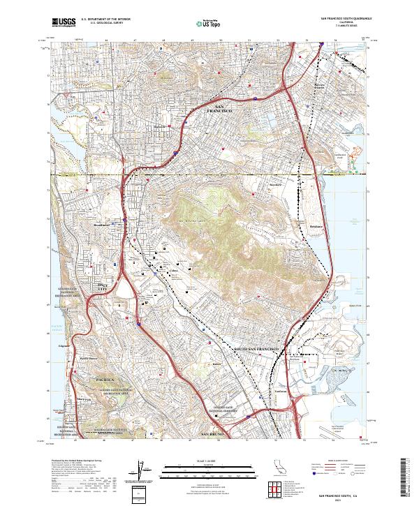
2021 Map of San Francisco South
USGS Topo · Published 2021About this map
Colma and the southern slopes of San Francisco emerge here as a landscape defined by expansive necropolises and high-density urban development. This corridor is notably occupied by a vast cluster of cemeteries, including Golden Gate National Cemetery, Cypress Lawn Memorial Park, and the Holy Cross Catholic Cem, reflecting the historical relocation of burial grounds from the city proper. The rugged elevation of San Bruno Mtn stands as a massive natural anchor between the urban sprawl of Daly City and the industrial waterfront of South San Francisco. Along the eastern shore, the infrastructure of the San Francisco International Airport and Candlestick Point underscores the region's role as a major Pacific transit hub, while educational landmarks like San Francisco State University and Skyline College are integrated into the dense residential fabric of the peninsula.
Find a feature on this map
69 named features on this map. Tap any name to fly to it.
Don’t see what you’re looking for? This feature index may not catch every label — zoom into the map to look around manually.
Map Details
Editions of this 2021 San Francisco South Map
This is the sole edition of this map. No revisions or reprints were ever made.
Other maps of this area

1892 · San Mateo
USGS Topo · 1:62,500

1895 · San Francisco
USGS Topo · 1:62,500

1896 · San Mateo
USGS Topo · 1:62,500

1897 · Tamalpais
USGS Topo · 1:62,500

1899 · San Francisco
USGS Topo · 1:62,500

1899 · San Mateo
USGS Topo · 1:62,500

1915 · San Mateo
USGS Topo · 1:62,500

1915 · San Francisco
USGS Topo · 1:62,500

1939 · San Mateo
USGS Topo · 1:62,500

1941 · Tamalpais
USGS Topo · 1:62,500