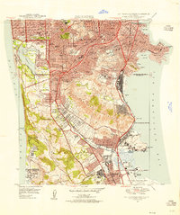
1947 Map of San Francisco South
USGS Topo · Published 1955About this map
The San Bruno Mountains dominate the center of this post-war landscape, providing a physical buffer between the dense urban grid of San Francisco and the expanding peninsula communities. In the northwest, the Fort Funston Military Reservation and the Harding Park Municipal Golf Course border Lake Merced, while the Southern Pacific railroad corridor guides development southward through Brisbane and South San Francisco. This era captures a significant concentration of memorial sites near Colma, including the Holy Cross Cemetery and Italian Cem, reflecting the city's historical relocation of its deceased. Along the bay shore, the map documents the early footprint of the San Francisco International Airport and the prominent Tanforan Race Track in San Bruno, moments before the regional aerospace and transit boom further transformed these coastal marshlands.
Find a feature on this map
88 named features on this map. Tap any name to fly to it.
Don’t see what you’re looking for? This feature index may not catch every label — zoom into the map to look around manually.
Map Details
Editions of this 1947 San Francisco South Map
This is the sole edition of this map. No revisions or reprints were ever made.
Other maps of this area

1892 · San Mateo
USGS Topo · 1:62,500

1895 · San Francisco
USGS Topo · 1:62,500

1896 · San Mateo
USGS Topo · 1:62,500

1897 · Tamalpais
USGS Topo · 1:62,500

1899 · San Francisco
USGS Topo · 1:62,500

1899 · San Mateo
USGS Topo · 1:62,500

1915 · San Mateo
USGS Topo · 1:62,500

1915 · San Francisco
USGS Topo · 1:62,500

1939 · San Mateo
USGS Topo · 1:62,500

1941 · Tamalpais
USGS Topo · 1:62,500