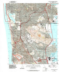
1993 Map of San Francisco South
USGS Topo · Published 1997About this map
San Bruno Mountain dominates the center of this peninsula landscape, serving as a massive topographical anchor between the dense residential grids of Daly City and South San Francisco. The map highlights a remarkable concentration of memorial grounds in Colma, including the sprawling Holy Cross Cemetery, Cypress Lawn Cemetery, and Hills of Eternity Cemetery, illustrating the town's unique role as a necropolis for the neighboring metropolis. Along the eastern shoreline, industrial and transit infrastructure is prominent, from the San Francisco International Airport to the Marine Corps Supply Annex and the iconic Cow Palace.
Find a feature on this map
95 named features on this map. Tap any name to fly to it.
Don’t see what you’re looking for? This feature index may not catch every label — zoom into the map to look around manually.
Map Details
Editions of this 1993 San Francisco South Map
This is the sole edition of this map. No revisions or reprints were ever made.
Other maps of this area

1892 · San Mateo
USGS Topo · 1:62,500

1895 · San Francisco
USGS Topo · 1:62,500

1896 · San Mateo
USGS Topo · 1:62,500

1897 · Tamalpais
USGS Topo · 1:62,500

1899 · San Francisco
USGS Topo · 1:62,500

1899 · San Mateo
USGS Topo · 1:62,500

1915 · San Mateo
USGS Topo · 1:62,500

1915 · San Francisco
USGS Topo · 1:62,500

1939 · San Mateo
USGS Topo · 1:62,500

1941 · Tamalpais
USGS Topo · 1:62,500