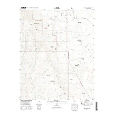
2013 Map of San Geronimo
USGS Topo · Published 2013About this map
The Sangre de Cristo Mountains dominate the western horizon of this San Miguel County landscape, where the high-altitude terrain of the Santa Fe National Forest meets the valley floor. Settlement is concentrated along the drainage of Tecolote Cr, where the community of San Geronimo and the nearby San Pablo represent established mountain villages. Local history is anchored at the San Geronimo Cem and San Pablo Cem, reflecting the enduring presence of family lineages in this New Mexican backcountry. The map reveals a transition from the peaks of Barillas Peak and the Santa Fe Mountains to the lower rangelands of Mineral Hill. Ranching life is evident through landmarks like Shearer Ranch and the San Geronimo Cabin, while the network of unpaved routes like Old Rancho Rd and Mesteno Rd suggests a landscape defined by livestock and timber access.
Find a feature on this map
48 named features on this map. Tap any name to fly to it.
Don’t see what you’re looking for? This feature index may not catch every label — zoom into the map to look around manually.
Map Details
Editions of this 2013 San Geronimo Map
This is the sole edition of this map. No revisions or reprints were ever made.
Other maps of this area

1889 · Las Vegas
USGS Topo · 1:125,000

1889 · Santa Fe
USGS Topo · 1:125,000

1890 · Bernal
USGS Topo · 1:125,000

1891 · Bernal
USGS Topo · 1:125,000

1891 · Las Vegas
USGS Topo · 1:125,000

1893 · Las Vegas
USGS Topo · 1:125,000

1894 · Santa Fe
USGS Topo · 1:125,000

1894 · Bernal
USGS Topo · 1:125,000

1894 · Lamy
USGS Topo · 1:125,000

1954 · Santa Fe
USGS Topo · 1:250,000