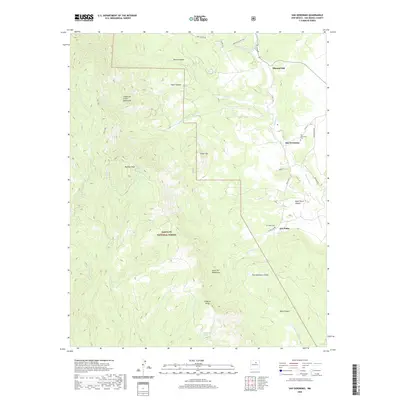
2020 Map of San Geronimo
USGS Topo · Published 2020About this map
San Geronimo and San Pablo anchor the eastern foothills of the Sangre de Cristo Mountains in this modern topographic study of San Miguel County. The landscape is defined by the transition from high peaks like Barillas Peak and the El Barro Peaks down to the drainage basins of Tecolote Cr and San Pablo Cr. For genealogists and local historians, the map provides precise locations for the San Geronimo Cem and San Pablo Cem, alongside the small settlement of Mineral Hill. Much of the western half of the quadrangle is occupied by the protected lands of the Santa Fe National Forest, where a network of water sources such as Barillas Spring and Mortandad Spring punctuate the high-elevation terrain.
Find a feature on this map
43 named features on this map. Tap any name to fly to it.
Don’t see what you’re looking for? This feature index may not catch every label — zoom into the map to look around manually.
Map Details
Editions of this 2020 San Geronimo Map
This is the sole edition of this map. No revisions or reprints were ever made.
Other maps of this area

1889 · Las Vegas
USGS Topo · 1:125,000

1889 · Santa Fe
USGS Topo · 1:125,000

1890 · Bernal
USGS Topo · 1:125,000

1891 · Bernal
USGS Topo · 1:125,000

1891 · Las Vegas
USGS Topo · 1:125,000

1893 · Las Vegas
USGS Topo · 1:125,000

1894 · Santa Fe
USGS Topo · 1:125,000

1894 · Bernal
USGS Topo · 1:125,000

1894 · Lamy
USGS Topo · 1:125,000

1954 · Santa Fe
USGS Topo · 1:250,000