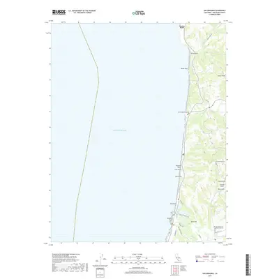
2018 Map of San Gregorio
USGS Topo · Published 2018About this map
Martins Beach and the high bluffs of Mussel Rock define this coastal stretch of San Mateo County, where the Santa Cruz Mountains meet the Pacific Ocean. This modern survey illustrates a landscape shaped by narrow canyons and coastal terraces, with Tunitas Creek and San Gregorio Creek cutting through the terrain toward the shore. The interior is marked by a network of historic routes like Stage Rd and Tunitas Creek Rd, which navigate the steep elevations of Gordon Ridge and Round Hill. Further south near the town of Pescadero, the map identifies local landmarks essential for genealogical research, including Saint Anthony Cem and Mount Hope Cem. The presence of several distinct gulches, such as Dairy Gulch and Tahana Gulch, suggests the intricate drainage patterns that have historically dictated land use and road placement in this rural coastal region.
Find a feature on this map
37 named features on this map. Tap any name to fly to it.
Don’t see what you’re looking for? This feature index may not catch every label — zoom into the map to look around manually.
Map Details
Editions of this 2018 San Gregorio Map
This is the sole edition of this map. No revisions or reprints were ever made.
Other maps of this area

1902 · Santa Cruz
USGS Topo · 1:125,000

1940 · Halfmoon Bay
USGS Topo · 1:62,500

1940 · Ano Nuevo
USGS Topo · 1:62,500

1941 · Ano Nuevo Pt.
USGS Topo · 1:62,500

1942 · Ano Nuevo
USGS Topo · 1:62,500

1943 · Halfmoon Bay
USGS Topo · 1:62,500

1947 · San Francisco
USGS Topo · 1:250,000

1948 · San Francisco
USGS Topo · 1:250,000

1948 · Ano Nuevo
USGS Topo · 1:62,500
1952 · Half Moon Bay
USGS Topo · 1:24,000