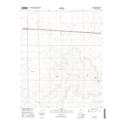
2017 Map of San Ignacio
USGS Topo · Published 2017About this map
San Ignacio serves as a primary settlement point in this corner of Guadalupe County, where the high desert terrain is defined by complex canyon systems and seasonal watercourses. The local landscape is marked by the winding path of Pintada Arroyo and the drainage of Cañada Bonita, which cut through the high ground. Genealogists will find the San Ignacio Cem located east of the main settlement, providing a specific point of interest for local family histories. To the north, the terrain levels out near Bull Lake, while the major transit corridor passes through Vegas Junction. Distinctive geological features like Puerto Haspe and the Rincón de la Manzanita illustrate the traditional Spanish nomenclature used to describe the local landforms and alcoves of the New Mexico interior.
Find a feature on this map
17 named features on this map. Tap any name to fly to it.
Don’t see what you’re looking for? This feature index may not catch every label — zoom into the map to look around manually.
Map Details
Editions of this 2017 San Ignacio Map
This is the sole edition of this map. No revisions or reprints were ever made.
Other maps of this area

1890 · Bernal
USGS Topo · 1:125,000

1891 · Bernal
USGS Topo · 1:125,000

1892 · Corazon
USGS Topo · 1:125,000

1894 · Corazon
USGS Topo · 1:125,000

1894 · Bernal
USGS Topo · 1:125,000

1954 · Santa Fe
USGS Topo · 1:250,000

1954 · Fort Sumner
USGS Topo · 1:250,000

1958 · Fort Sumner
USGS Topo · 1:250,000

1958 · Santa Fe
USGS Topo · 1:250,000

1963 · Colonias
USGS Topo · 1:24,000