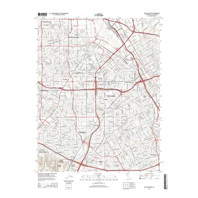
2015 Map of San Jose West
USGS Topo · Published 2015About this map
San Jose and Santa Clara form the urban core of this mid-2010s survey, showing the intensive development and historic institutions of the Silicon Valley region. The map highlights significant educational landmarks like Santa Clara University and San Jose State University, alongside the expansive grounds of Norman Y Mineta San Jose International Airport. For genealogists and local historians, the sheet preserves the locations of the Santa Clara Catholic Cemetery and Mission City Memorial Park. The natural landscape is defined by the drainage network of the Guadalupe River, Los Gatos Creek, and Coyote Creek, which thread through dense residential and commercial districts. Major transportation corridors like El Camino Real and the Central Expressway link established neighborhoods such as Willow Glen and Burbank with the growing communities of Campbell and Cupertino.
Find a feature on this map
48 named features on this map. Tap any name to fly to it.
Don’t see what you’re looking for? This feature index may not catch every label — zoom into the map to look around manually.
Map Details
Editions of this 2015 San Jose West Map
This is the sole edition of this map. No revisions or reprints were ever made.
Other maps of this area

1889 · San Jose
USGS Topo · 1:62,500

1897 · San Jose
USGS Topo · 1:62,500

1897 · Palo Alto
USGS Topo · 1:62,500

1899 · San Jose
USGS Topo · 1:62,500

1899 · Palo Alto
USGS Topo · 1:62,500

1902 · Santa Cruz
USGS Topo · 1:125,000

1916 · New Almaden
USGS Topo · 1:48,000

1919 · New Almaden
USGS Topo · 1:62,500

1940 · Los Gatos
USGS Topo · 1:62,500

1941 · Palo Alto
USGS Topo · 1:62,500