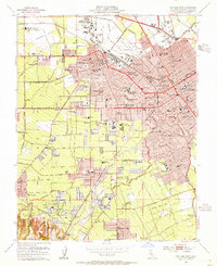
1953 Map of San Jose West
USGS Topo · Published 1955About this map
Santa Clara County’s post-war transition is evident across this landscape, where the agricultural past of the Santa Clara Valley meets rapid mid-century suburban expansion. The urban centers of Santa Clara and San Jose are densely detailed, showing the concentration of civic life around Washington Square, the Post Office, and City Hall. Educational and religious institutions anchor the growing neighborhoods, from the historic grounds of Bellarmine College Preparatory and the Carmelite Monastery to dozens of local schools like Jefferson Union Sch and Willow Glen High Sch.
Find a feature on this map
96 named features on this map. Tap any name to fly to it.
Don’t see what you’re looking for? This feature index may not catch every label — zoom into the map to look around manually.
Map Details
Editions of this 1953 San Jose West Map
This is the sole edition of this map. No revisions or reprints were ever made.
Other maps of this area

1889 · San Jose
USGS Topo · 1:62,500

1897 · San Jose
USGS Topo · 1:62,500

1897 · Palo Alto
USGS Topo · 1:62,500

1899 · San Jose
USGS Topo · 1:62,500

1899 · Palo Alto
USGS Topo · 1:62,500

1902 · Santa Cruz
USGS Topo · 1:125,000

1916 · New Almaden
USGS Topo · 1:48,000

1919 · New Almaden
USGS Topo · 1:62,500

1940 · Los Gatos
USGS Topo · 1:62,500

1941 · Palo Alto
USGS Topo · 1:62,500