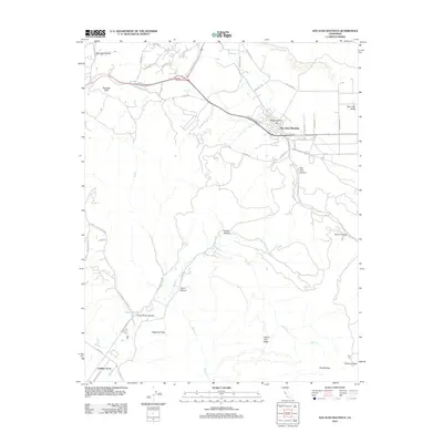
2012 Map of San Juan Bautista
USGS Topo · Published 2012About this map
San Juan Bautista serves as the focal point of this coastal California region, situated where the San Juan Valley meets the rising terrain of the Gabilan Range. This 2012 survey illustrates the area's complex geography, defined by numerous canyons such as Crazy Horse Canyon, French Canyon, and Vierra Canyon. To the north, the San Benito River winds through the landscape, while the southern portion is dominated by prominent summits including Sugarloaf Peak and Fremont Peak. Local infrastructure is marked by historic routes like Old Stage Rd and San Juan Grade Rd, which follow the natural contours of the land. The presence of Popeloutchom and Gabilan Acres highlights the distribution of settlements between the lowlands and the ridgelines of Cherry Tree Ridge and Rocky Ridge.
Find a feature on this map
49 named features on this map. Tap any name to fly to it.
Don’t see what you’re looking for? This feature index may not catch every label — zoom into the map to look around manually.
Map Details
Editions of this 2012 San Juan Bautista Map
This is the sole edition of this map. No revisions or reprints were ever made.
Other maps of this area

1910 · Salinas
USGS Topo · 1:31,680

1912 · Salinas
USGS Topo · 1:62,500

1915 · San Juan Bautista
USGS Topo · 1:48,000

1917 · San Juan Bautista
USGS Topo · 1:62,500

1919 · Hollister
USGS Topo · 1:48,000

1921 · Gonzales
USGS Topo · 1:62,500

1921 · Hollister
USGS Topo · 1:62,500

1923 · Hollister
USGS Topo · 1:62,500

1939 · San Juan Bautista
USGS Topo · 1:62,500

1940 · San Juan Bautista
USGS Topo · 1:62,500