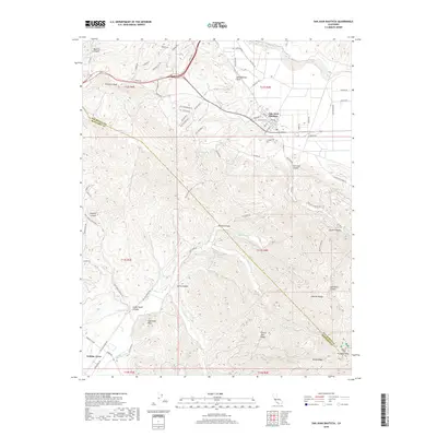
2018 Map of San Juan Bautista
USGS Topo · Published 2018About this map
San Juan Bautista sits at the foot of the rising Gabilan Range on this modern survey, where the historic town grid meets the notable path of the San Andreas Fault. The landscape is defined by its deep canyons and prominent summits, including the northern reaches of the range leading toward Fremont Peak and the high point of Sugarloaf Peak. To the west, Crazy Horse Canyon and Pesante Canyon carve through the terrain near Gabilan Acres, while the San Benito River flows along the northern boundary. The map provides a contemporary view of the region's complex topography, including the winding course of Gabilan Cr and the secluded Steinbeck Canyon. Named for the local geography, the area shows a clear divide between the agricultural flats near the river and the steep, ridge-bound terrain of Cherry Tree Ridge and Rocky Ridge.
Find a feature on this map
83 named features on this map. Tap any name to fly to it.
Don’t see what you’re looking for? This feature index may not catch every label — zoom into the map to look around manually.
Map Details
Editions of this 2018 San Juan Bautista Map
This is the sole edition of this map. No revisions or reprints were ever made.
Other maps of this area

1910 · Salinas
USGS Topo · 1:31,680

1912 · Salinas
USGS Topo · 1:62,500

1915 · San Juan Bautista
USGS Topo · 1:48,000

1917 · San Juan Bautista
USGS Topo · 1:62,500

1919 · Hollister
USGS Topo · 1:48,000

1921 · Gonzales
USGS Topo · 1:62,500

1921 · Hollister
USGS Topo · 1:62,500

1923 · Hollister
USGS Topo · 1:62,500

1939 · San Juan Bautista
USGS Topo · 1:62,500

1940 · San Juan Bautista
USGS Topo · 1:62,500