2022 Map of San Juan Capistrano
USGS Topo · Published 2022About this map
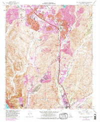
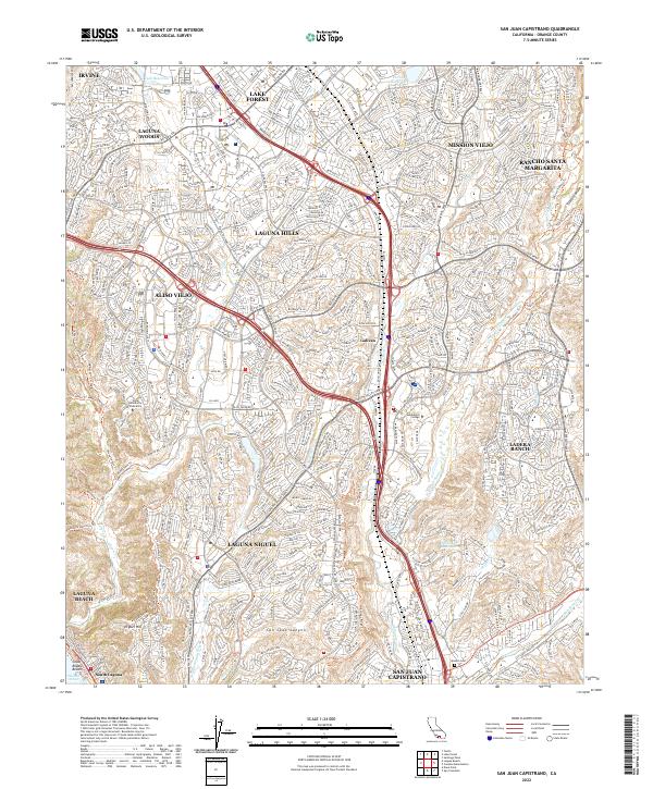
San Juan Capistrano and its surrounding suburban landscape are defined by a complex network of residential development and preserved open spaces. The map illustrates how modern master-planned communities like Laguna Niguel and Aliso Viejo have integrated with the physical geography of the Sheep Hills and Niguel Hill. Significant institutional footprints are visible at Soka University of America and Saddleback College, while the historic Mission Cem serves as a grounded link to the area's deeper heritage. The drainage patterns of Arroyo Trabuco and Aliso Cr carve through the built environment, providing natural corridors that contrast with the dense arterial grid of Crown Valley Pkwy and El Toro Rd. Along the coast, the transition from canyon to sea is marked at South Laguna and Coast Royale Beach.
Find a feature on this map
54 named features on this map. Tap any name to fly to it.
Don’t see what you’re looking for? This feature index may not catch every label — zoom into the map to look around manually.
Map Details
Editions of this 2022 San Juan Capistrano Map
This is the sole edition of this map. No revisions or reprints were ever made.
Historical Maps of Acacia Knolls Through Time
6 maps found