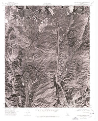
1974 Map of San Juan Capistrano
USGS Topo · Published 1977About this map
The coastal hills and developing residential corridors of San Juan Capistrano are captured here in remarkable detail during the mid-1970s. This orthophotomap, produced from aerial photography taken in November 1974, provides a sharp overhead perspective of Southern California's rapid suburban expansion into the surrounding canyons and ridgelines. While the historic center of San Juan Capistrano is visible in the lower portion of the sheet, the imagery highlights the striking contrast between the concentrated new housing developments to the north and the large swaths of undeveloped, grass-covered hills that characterized the regional landscape before more extensive modern infill. The network of winding residential streets and major transportation arteries reveals a community in the midst of a significant transformation, moving from its mission-era roots toward becoming a major Orange County suburban hub.
Find a feature on this map
1 named feature on this map. Tap any name to fly to it.
Don’t see what you’re looking for? This feature index may not catch every label — zoom into the map to look around manually.
Map Details
Editions of this 1974 San Juan Capistrano Map
This is the sole edition of this map. No revisions or reprints were ever made.
Other maps of this area

1896 · Santa Ana
USGS Topo · 1:62,500

1901 · Southern California Sheet No. 1
USGS Topo · 1:250,000

1901 · Santa Ana
USGS Topo · 1:62,500

1902 · Capistrano
USGS Topo · 1:125,000

1902 · Corona
USGS Topo · 1:125,000

1904 · Southern California Sheet No. 2
USGS Topo · 1:250,000

1904 · Southern California Sheet No. 1
USGS Topo · 1:250,000

1906 · Capistrano
USGS Topo · 1:125,000

1932 · Tustin
USGS Topo · 1:31,680
1935 · Tustin
USGS Topo · 1:31,680