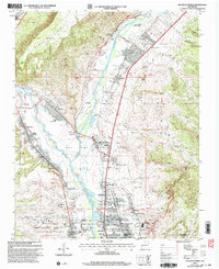
2002 Map of San Juan Pueblo
USGS Topo · Published 2003About this map
The Rio Grande and Rio Chama converge in this northern New Mexico landscape, a region deeply rooted in both indigenous and colonial history. The map highlights the significant site of Old San Juan First Spanish Capitol 1598, situated near the traditional center of San Juan Pueblo. The settlement pattern follows the fertile river valleys, where an intricate network of ditches and levees supports the agricultural life of communities like Alcalde, La Villita, and Chamita.
Find a feature on this map
79 named features on this map. Tap any name to fly to it.
Don’t see what you’re looking for? This feature index may not catch every label — zoom into the map to look around manually.
Map Details
Editions of this 2002 San Juan Pueblo Map
This is the sole edition of this map. No revisions or reprints were ever made.
Other maps of this area

1889 · Santa Fe
USGS Topo · 1:125,000

1892 · Santa Clara
USGS Topo · 1:125,000

1894 · Santa Fe
USGS Topo · 1:125,000

1918 · Abiquiu
USGS Topo · 1:125,000

1952 · Puye
USGS Topo · 1:24,000

1953 · Espanola
USGS Topo · 1:24,000

1953 · Chili
USGS Topo · 1:24,000

1953 · Medanales
USGS Topo · 1:24,000

1953 · San Juan Pueblo
USGS Topo · 1:24,000

1953 · Lyden
USGS Topo · 1:24,000