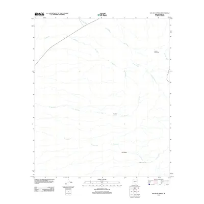
2011 Map of San Juan Spring
USGS Topo · Published 2011About this map
Gu Chuapo sits at the base of the Quinlan Mountains in this arid Pima County landscape, where water and topography define the pattern of settlement and movement. The map illustrates a complex drainage network vital to this desert environment, dominated by the long courses of Pavo Kug Wash, Sells Wash, and the southern Ali Molina Wash. These ephemeral watercourses converge and diverge across the terrain, carving out significant landforms such as San Juan Canyon and Ali Molina Canyon. A rare point of permanent water is identified at San Juan Spring along the banks of the San Juan Wash. This 2011 survey captures the area as it is traversed by Route 86, showing how modern infrastructure follows the natural corridors established by the ancient wash systems and the eastern slopes of the Quinlan range.
Find a feature on this map
11 named features on this map. Tap any name to fly to it.
Don’t see what you’re looking for? This feature index may not catch every label — zoom into the map to look around manually.
Map Details
Editions of this 2011 San Juan Spring Map
This is the sole edition of this map. No revisions or reprints were ever made.
Other maps of this area

1934 · Silver Bell
USGS Topo · 1:125,000

1937 · Comobabi
USGS Topo · 1:48,000

1938 · San Vicente
USGS Topo · 1:62,500

1941 · San Vicente
USGS Topo · 1:62,500

1941 · Baboquivari Peak
USGS Topo · 1:62,500

1941 · Sells
USGS Topo · 1:62,500

1942 · San Vicente
USGS Topo · 1:62,500

1942 · Comobabi
USGS Topo · 1:62,500

1943 · Sells
USGS Topo · 1:62,500

1943 · Fresnal
USGS Topo · 1:125,000