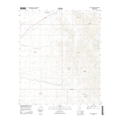
2014 Map of San Juan Spring
USGS Topo · Published 2014About this map
Haivana Nakya and Gu Chuapo anchor this 2014 survey of the Arizona desert, where the drainage systems of the Quinlan Mountains and Baboquivari Mountains define the geography. The landscape is marked by a complex network of ephemeral waterways, including Sells Wash, Pavo Kug Wash, and Ali Molina Wash, which flow from high ridges toward the valley floors. In an area where water is the primary architect of the terrain, San Juan Spring represents a vital point of interest tucked within San Juan Canyon. Transportation in this region is limited to the northern corridor along Az-86 and the specialized route of S Kitt Peak Rd, reflecting the remote and specialized nature of this part of Pima County. For those researching the Tohono O'odham Nation or local hydrology, the map provides precise placement of canyons and washes such as Ali Molina Canyon and San Vicente Wash.
Find a feature on this map
20 named features on this map. Tap any name to fly to it.
Don’t see what you’re looking for? This feature index may not catch every label — zoom into the map to look around manually.
Map Details
Editions of this 2014 San Juan Spring Map
This is the sole edition of this map. No revisions or reprints were ever made.
Other maps of this area

1934 · Silver Bell
USGS Topo · 1:125,000

1937 · Comobabi
USGS Topo · 1:48,000

1938 · San Vicente
USGS Topo · 1:62,500

1941 · San Vicente
USGS Topo · 1:62,500

1941 · Baboquivari Peak
USGS Topo · 1:62,500

1941 · Sells
USGS Topo · 1:62,500

1942 · San Vicente
USGS Topo · 1:62,500

1942 · Comobabi
USGS Topo · 1:62,500

1943 · Sells
USGS Topo · 1:62,500

1943 · Fresnal
USGS Topo · 1:125,000