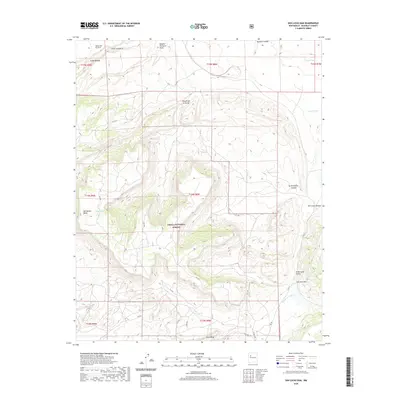
2020 Map of San Lucas Dam
USGS Topo · Published 2020About this map
Cibola National Forest encompasses much of this high-desert terrain in McKinley County, defined by a complex network of canyons and mesas. The landscape is marked by the presence of numerous livestock tanks such as Piedra Tank, Michael Tank, and Baca Tank, which are vital water sources for this arid environment. Significant topographic features like San Mateo Mesa and Jesus Mesa rise above the drainage systems of La Polvadera Canyon and Chole Canyon, illustrating the erosive forces that have shaped the region. Near the southeastern edge, the San Lucas Dam stands at the head of El Derrame Cañon, an area further detailed by local routes like Jesus Mesa Rd and Co Rd 75. These markers of human engineering and the cattle-grazing economy, including the specifically named Rancho Perfecto Point, reflect the ongoing land use patterns within this federally managed wilderness.
Find a feature on this map
35 named features on this map. Tap any name to fly to it.
Don’t see what you’re looking for? This feature index may not catch every label — zoom into the map to look around manually.
Map Details
Editions of this 2020 San Lucas Dam Map
This is the sole edition of this map. No revisions or reprints were ever made.
Other maps of this area

1883 · Mt. Taylor
USGS Topo · 1:250,000

1886 · Mt. Taylor
USGS Topo · 1:250,000

1892 · Mt. Taylor
USGS Topo · 1:250,000

1899 · Mt. Taylor
USGS Topo · 1:250,000

1957 · Ambrosia Lake
USGS Topo · 1:24,000

1957 · Dos Lomas
USGS Topo · 1:24,000

1958 · Albuquerque
USGS Topo · 1:250,000

1961 · El Dado
USGS Topo · 1:24,000

1961 · Piedra De La Aguila
USGS Topo · 1:24,000

1962 · Albuquerque
USGS Topo · 1:250,000