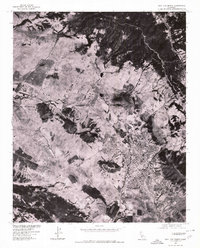
1976 Map of San Luis Obispo
USGS Topo · Published 1980About this map
San Luis Obispo is captured in sharp detail by this orthophotoquad, which utilizes imagery taken on June 28, 1976. Unlike traditional topographic maps, this aerial perspective reveals the exact physical footprint of the city and its surrounding infrastructure as they appeared in the mid-1970s. The urban grid of San Luis Obispo is clearly visible in the southeastern portion of the sheet, while the military installations at Camp San Luis Obispo occupy the western landscape. Produced in cooperation with the Soil Conservation Service, the map highlights the distinct boundaries between the developing residential areas and the surrounding agricultural or open lands near Bishop. This photographic record provides a precise visual baseline for understanding the regional settlement patterns and land use before the expansion of the later 20th century.
Find a feature on this map
3 named features on this map. Tap any name to fly to it.
Don’t see what you’re looking for? This feature index may not catch every label — zoom into the map to look around manually.
Map Details
Editions of this 1976 San Luis Obispo Map
This is the sole edition of this map. No revisions or reprints were ever made.
Other maps of this area

1897 · Port Harford
USGS Topo · 1:62,500

1897 · San Luis Obispo
USGS Topo · 1:62,500

1897 · Cayucos
USGS Topo · 1:62,500

1897 · Arroyo Grande
USGS Topo · 1:62,500

1900 · San Luis
USGS Topo · 1:125,000

1937 · Cayucos
USGS Topo · 1:62,500

1941 · Port San Luis
USGS Topo · 1:62,500

1942 · San Luis Obispo
USGS Topo · 1:62,500

1942 · Arroyo Grande
USGS Topo · 1:62,500

1943 · Cayucos
USGS Topo · 1:62,500