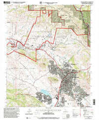
1995 Map of San Luis Obispo
USGS Topo · Published 2000About this map
San Luis Obispo is presented at a point of significant institutional and educational growth in the mid-1990s. The city's downtown core, anchored by the Old Mission San Luis Obispo de Tolosa and local government seats, transitions into the sprawling campus of California Polytechnic State University and residential neighborhoods defined by streets like Higuera St and Monterey St. The landscape is physically bounded by dramatic peaks including Bishop Peak and Cerro San Luis Obispo, while historical land grants like the Huerta de Romualdo Grant still frame property divisions.
Find a feature on this map
77 named features on this map. Tap any name to fly to it.
Don’t see what you’re looking for? This feature index may not catch every label — zoom into the map to look around manually.
Map Details
Editions of this 1995 San Luis Obispo Map
This is the sole edition of this map. No revisions or reprints were ever made.
Other maps of this area

1897 · Port Harford
USGS Topo · 1:62,500

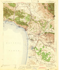
1897 · San Luis Obispo
USGS Topo · 1:62,500

1897 · Cayucos
USGS Topo · 1:62,500

1897 · Arroyo Grande
USGS Topo · 1:62,500

1900 · San Luis
USGS Topo · 1:125,000

1937 · Cayucos
USGS Topo · 1:62,500

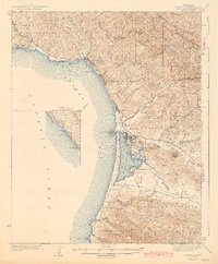
1941 · Port San Luis
USGS Topo · 1:62,500

1942 · San Luis Obispo
USGS Topo · 1:62,500
1942 · Arroyo Grande
USGS Topo · 1:62,500
1943 · Cayucos
USGS Topo · 1:62,500