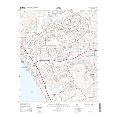
2015 Map of San Luis Rey
USGS Topo · Published 2015About this map
The coastal corridor of northern San Diego County is shown in a period of high density, where the distinct boundaries between Oceanside, Carlsbad, and Vista have largely dissolved into a continuous suburban and commercial landscape. Significant institutional footprints define the area, from the sprawling campus of Mira Costa College near Loma Alta Mtn to the Gemological Institute of America located near the southern edge. The map captures the complex drainage systems of the region, including the San Luis Rey River and the protected waters of the Buena Vista Lagoon and Agua Hedionda. Genealogical points of interest include the San Luis Rey Cemetery and Eternal Hills Memorial Park. The infrastructure of the era is evident in the detailed street grids and major hubs like the Oceanside Municipal Airport and Mc Clellan-Palomar Airport.
Find a feature on this map
60 named features on this map. Tap any name to fly to it.
Don’t see what you’re looking for? This feature index may not catch every label — zoom into the map to look around manually.
Map Details
Editions of this 2015 San Luis Rey Map
This is the sole edition of this map. No revisions or reprints were ever made.
Other maps of this area

1893 · Oceanside
USGS Topo · 1:62,500

1893 · Escondido
USGS Topo · 1:62,500

1898 · Oceanside
USGS Topo · 1:62,500

1901 · Escondido
USGS Topo · 1:62,500

1901 · Oceanside
USGS Topo · 1:62,500

1901 · San Luis Rey
USGS Topo · 1:125,000

1904 · Southern California Sheet No. 2
USGS Topo · 1:250,000

1941 · Margarita Peak
USGS Topo · 1:62,500

1942 · Margarita Peak
USGS Topo · 1:62,500

1942 · Temecula
USGS Topo · 1:62,500