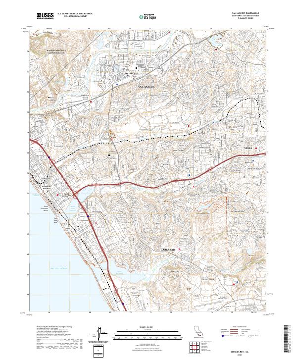
2022 Map of San Luis Rey
USGS Topo · Published 2022About this map
The Old Mission San Luis Rey stands as a central historical landmark in this North County coastal landscape, surrounded by several significant burial grounds including the San Luis Rey Pioneer Cem and All Saints Cem. The map documents a highly developed transit and aviation network, anchored by the Bob Maxwell Memorial Airfield in the north and McClellan-Palomar Airport to the south. Modern infrastructure is deeply integrated with the natural geography, as seen where the Carlsbad Coastal Rail Trl parallels the shoreline of South Oceanside Beach. Protected coastal environments like the Buena Vista Lagoon and the Loma Alta Marsh provide a counterpoint to the dense residential grids of Oceanside, Carlsbad, and Vista. Educational and institutional presence is noted through the sprawling campus of Mira Costa College and the Gemological Institute of America, reflecting the region's mid-century and modern growth.
Find a feature on this map
70 named features on this map. Tap any name to fly to it.
Don’t see what you’re looking for? This feature index may not catch every label — zoom into the map to look around manually.
Map Details
Editions of this 2022 San Luis Rey Map
This is the sole edition of this map. No revisions or reprints were ever made.
Other maps of this area

1893 · Oceanside
USGS Topo · 1:62,500

1893 · Escondido
USGS Topo · 1:62,500

1898 · Oceanside
USGS Topo · 1:62,500

1901 · Escondido
USGS Topo · 1:62,500

1901 · Oceanside
USGS Topo · 1:62,500

1901 · San Luis Rey
USGS Topo · 1:125,000

1904 · Southern California Sheet No. 2
USGS Topo · 1:250,000

1941 · Margarita Peak
USGS Topo · 1:62,500

1942 · Margarita Peak
USGS Topo · 1:62,500

1942 · Temecula
USGS Topo · 1:62,500