1961 Map of San Luis
USGS Topo · Published 1964About this map
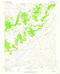
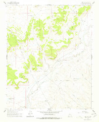
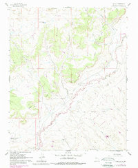
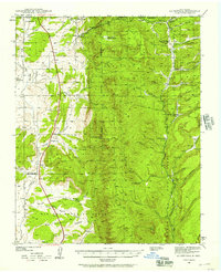
Rio Puerco flows through this 1961 survey of Sandoval County, cutting a deep path through the high desert of northern New Mexico. The landscape is defined by massive formations like San Luis Mesa and Bosque Grande Mesa, which dominate the central terrain. Land use here is rooted in expansive historic tracts, specifically the M and S Montoya Grant and the Ojo del Espiritu Santo Grant, where traditional boundaries intersect with modern infrastructure like a prominent Pipeline.
Find a feature on this map
27 named features on this map. Tap any name to fly to it.
Don’t see what you’re looking for? This feature index may not catch every label — zoom into the map to look around manually.
Map Details
Editions of this 1961 San Luis Map
3 editions found
Other maps of this area

1883 · Mt. Taylor
USGS Topo · 1:250,000

1886 · Mt. Taylor
USGS Topo · 1:250,000

1890 · Jemes
USGS Topo · 1:125,000

1892 · Jemes
USGS Topo · 1:125,000

1892 · Mt. Taylor
USGS Topo · 1:250,000

1899 · Mt. Taylor
USGS Topo · 1:250,000
1939 · La Ventana
USGS Topo · 1:62,500

1939 · San Ysidro
USGS Topo · 1:62,500

1943 · San Ysidro
USGS Topo · 1:62,500

1943 · La Ventana
USGS Topo · 1:62,500