1961 Map of San Luis
USGS Topo · Published 1978About this map
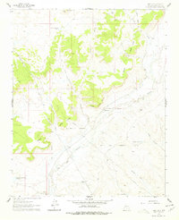
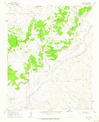
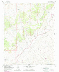
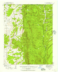
The Rio Puerco carves a winding path through this high desert terrain in the early 1960s, defining the landscape between the M and S Montoya Grant Boundary and the Ojo Del Espiritu Santo Grant. The small settlement of San Luis serves as a focal point, situated near the dramatic elevation of San Luis Mesa and Mesa Grande. Further south, the map details the community of Cabezon, accompanied by a Cem and the Cabezon Community Reservoir. Water management is a critical theme across these arid lands, evidenced by the numerous named tanks and wells, including Cherrin Well and Divide Tank. The intricate network of seasonal drainages, such as Arroyo de los Viejos and Arroyo Chavez, illustrates the complex erosional patterns that have shaped the Sandoval County geography over generations.
Find a feature on this map
38 named features on this map. Tap any name to fly to it.
Don’t see what you’re looking for? This feature index may not catch every label — zoom into the map to look around manually.
Map Details
Editions of this 1961 San Luis Map
3 editions found
Other maps of this area

1883 · Mt. Taylor
USGS Topo · 1:250,000

1886 · Mt. Taylor
USGS Topo · 1:250,000

1890 · Jemes
USGS Topo · 1:125,000

1892 · Jemes
USGS Topo · 1:125,000

1892 · Mt. Taylor
USGS Topo · 1:250,000

1899 · Mt. Taylor
USGS Topo · 1:250,000
1939 · La Ventana
USGS Topo · 1:62,500

1939 · San Ysidro
USGS Topo · 1:62,500

1943 · San Ysidro
USGS Topo · 1:62,500

1943 · La Ventana
USGS Topo · 1:62,500