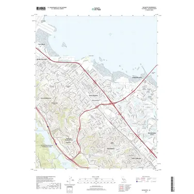
2018 Map of San Mateo
USGS Topo · Published 2018About this map
The urbanized corridor of the San Francisco Peninsula is showcased here, where the eastern slopes of the Santa Cruz Mountains meet the shores of San Francisco Bay. In this 2018 study, dense residential neighborhoods such as San Mateo Park and Hayward Park are established between the saltwater marshes of Foster City and the high ridges to the west. The landscape is defined by its water management and coastal geography, featuring the vast Lower Crystal Springs Reservoir and Upper Crystal Springs Reservoir tucked behind Buri Buri Ridge. Along the bayfront, the intricate lagoon systems of Redwood Shores Lagoon and the named residential isles like Dolphin Isle and Surfbird Isle illustrate the modern reclamation of the shoreline. The transition from the flat bay plain to the elevated terrain of Pulgas Ridge and Sugarloaf Hill highlights the geographic constraints that have shaped the development of San Mateo, Belmont, and San Carlos.
Find a feature on this map
63 named features on this map. Tap any name to fly to it.
Don’t see what you’re looking for? This feature index may not catch every label — zoom into the map to look around manually.
Map Details
Editions of this 2018 San Mateo Map
This is the sole edition of this map. No revisions or reprints were ever made.
Other maps of this area

1892 · San Mateo
USGS Topo · 1:62,500

1896 · San Mateo
USGS Topo · 1:62,500

1897 · Palo Alto
USGS Topo · 1:62,500

1899 · Palo Alto
USGS Topo · 1:62,500

1899 · Haywards
USGS Topo · 1:62,500

1899 · San Mateo
USGS Topo · 1:62,500

1902 · Santa Cruz
USGS Topo · 1:125,000

1915 · San Mateo
USGS Topo · 1:62,500

1915 · Haywards
USGS Topo · 1:62,500

1939 · San Mateo
USGS Topo · 1:62,500