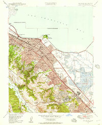
1947 Map of San Mateo
USGS Topo · Published 1957About this map
San Francisco Bay dominates the eastern horizon of this mid-century Peninsula landscape, where industrial infrastructure meets rapid post-war suburban growth. The Southern Pacific railroad and the Bayshore Highway form the primary transportation corridor through San Mateo, Burlingame, and Belmont. A striking mix of recreation and specialized institutions defines the era, from the Bay Meadows Race Track and Gymkhana Club to medical facilities like the California Sanitarium and San Mateo Co Relief Home.
Find a feature on this map
82 named features on this map. Tap any name to fly to it.
Don’t see what you’re looking for? This feature index may not catch every label — zoom into the map to look around manually.
Map Details
Editions of this 1947 San Mateo Map
This is the sole edition of this map. No revisions or reprints were ever made.
Other maps of this area

1892 · San Mateo
USGS Topo · 1:62,500

1896 · San Mateo
USGS Topo · 1:62,500

1897 · Palo Alto
USGS Topo · 1:62,500

1899 · Palo Alto
USGS Topo · 1:62,500

1899 · Haywards
USGS Topo · 1:62,500

1899 · San Mateo
USGS Topo · 1:62,500

1902 · Santa Cruz
USGS Topo · 1:125,000

1915 · San Mateo
USGS Topo · 1:62,500

1915 · Haywards
USGS Topo · 1:62,500

1939 · San Mateo
USGS Topo · 1:62,500