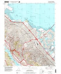
1997 Map of San Mateo
USGS Topo · Published 1999About this map
San Francisco Bay defines the eastern edge of this late-1990s Peninsula landscape, where the San Mateo Bridge meets a complex network of lagoons and waterways like Seal Slough. The topography transitions sharply from the master-planned residential blocks of Foster City to the steep ridges of the Golden Gate National Recreation Area. Significant infrastructure and recreational landmarks dot the corridor, including the Bay Meadows Racetrack and the Fiesta Grounds, which served as regional gathering points for decades.
Find a feature on this map
52 named features on this map. Tap any name to fly to it.
Don’t see what you’re looking for? This feature index may not catch every label — zoom into the map to look around manually.
Map Details
Editions of this 1997 San Mateo Map
This is the sole edition of this map. No revisions or reprints were ever made.
Other maps of this area

1892 · San Mateo
USGS Topo · 1:62,500

1896 · San Mateo
USGS Topo · 1:62,500

1897 · Palo Alto
USGS Topo · 1:62,500

1899 · Palo Alto
USGS Topo · 1:62,500

1899 · Haywards
USGS Topo · 1:62,500

1899 · San Mateo
USGS Topo · 1:62,500

1902 · Santa Cruz
USGS Topo · 1:125,000

1915 · San Mateo
USGS Topo · 1:62,500

1915 · Haywards
USGS Topo · 1:62,500

1939 · San Mateo
USGS Topo · 1:62,500