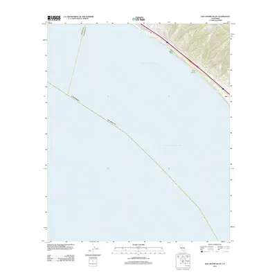
2012 Map of San Onofre Bluff
USGS Topo · Published 2012About this map
San Onofre Bluff defines the narrow coastal corridor shown here along the southern California shore. This 2012 survey by the U. S. Geological Survey focuses on the thin margin where the land meets the Pacific Ocean, specifically within the Gulf of Santa Catalina. The landscape is dominated by the steep coastal terraces and drainage features like Foley Canyon, which cut through the bluffs toward the sea. Transportation history is evident in the inclusion of Old Hwy 101, the iconic route that served as the primary north-south artery before modern interstates. The small rail or settlement point at Agra sits near the southeastern edge of the sheet, representing one of the few named landmarks in this largely open coastal stretch.
Find a feature on this map
6 named features on this map. Tap any name to fly to it.
Don’t see what you’re looking for? This feature index may not catch every label — zoom into the map to look around manually.
Map Details
Editions of this 2012 San Onofre Bluff Map
This is the sole edition of this map. No revisions or reprints were ever made.
Other maps of this area

1893 · Oceanside
USGS Topo · 1:62,500

1898 · Oceanside
USGS Topo · 1:62,500

1901 · Oceanside
USGS Topo · 1:62,500

1901 · San Luis Rey
USGS Topo · 1:125,000

1902 · Capistrano
USGS Topo · 1:125,000

1904 · Southern California Sheet No. 2
USGS Topo · 1:250,000

1906 · Capistrano
USGS Topo · 1:125,000

1941 · Margarita Peak
USGS Topo · 1:62,500

1942 · Margarita Peak
USGS Topo · 1:62,500

1942 · San Juan Capistrano
USGS Topo · 1:62,500
Featured Places
- San Clemente, CA
- Marine Corps Base Camp Pendleton, CA
- Agra, Marine Corps Base Camp Pendleton
- San Diego County, CA
- Orange County, CA